
Google Maps API
Overview
Utilizing Places / Locations APIs, (i.e. Google Places API and Google Geolocation API , or any alternatives) are essential for smooth operation of the Search Flow.
These APIs play a critical role in handling key parameters, namely 'GeoLocation' and 'RadiusInMeter' which are vital for conducting GeoLocation based Search Hotels request and also - managing property data effectively.
These APIs offer a range of valuable features, including auto-complete for search box and the retrieval of Geo locations for your specified destinations or cities, making them indispensable tools for your system.
Google Maps API in Back-Office
Auto-Complete
When using our Back-Office search feature, you'll notice that as you type in any destination or city, HSP automatically suggests search results:
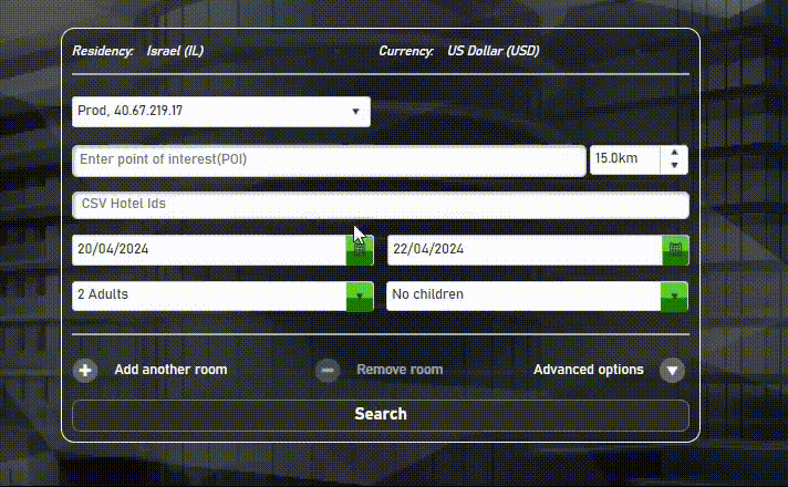
Back-Office: auto-complete locations.
Geo Locations
Once you select a destination or city and initiate the search by clicking the 'Search' button, the chosen location's 'GeoLocation' information will be retrieved using the Google Places API. Additionally, you can adjust the Radius parameter, which is mandatory when searching by 'GeoLocation,' ranging from 0 to 75 kilometers.
By combining 'GeoLocation' with the specified 'RadiusInMeter,' the system will search for hotels that fall within this geographical area and look for available hotels and rooms that meet the specified criteria.
'GeoLocation' + Radius
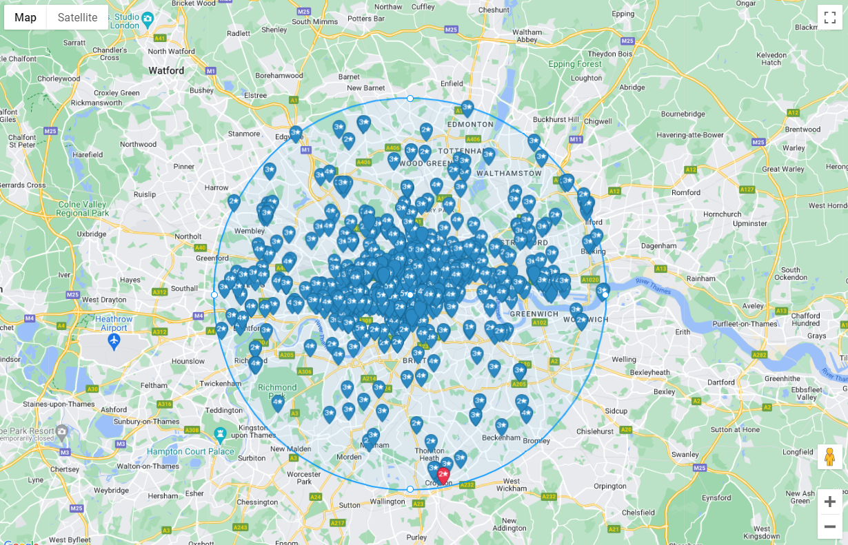
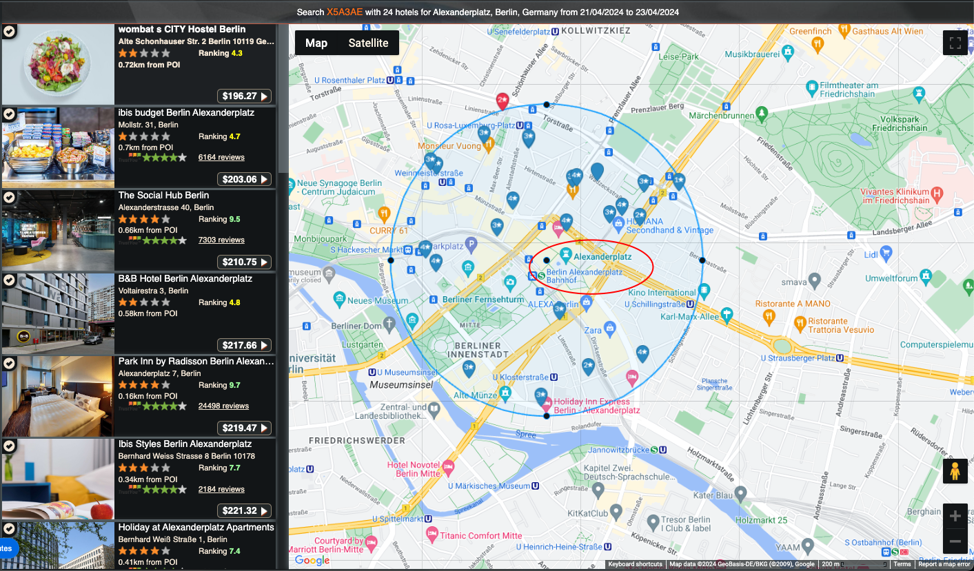
Map view
After the search results are generated and displayed, you'll notice that HSP shows available hotels on the left side, while the corresponding locations and their respective statuses are presented on the right side.
If you click on any hotel, it will highlight and show the exact location of that hotel within the displayed area. Likewise, if you click on the location indicators on the map, it will select the corresponding hotel on the left side.
Searching & Filtering
Search by POI
When conducting Point of Interest (POI) searches within our Back-Office system, the Geocoding API converts each point of interest into its corresponding latitude and longitude coordinates.
Subsequently, this enables us to forward the accurate coordinates to HSP's API.
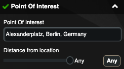
When selecting a Point of Interest (POI) during a search, for instance, 'Alexanderplatz, Berlin, Germany,'
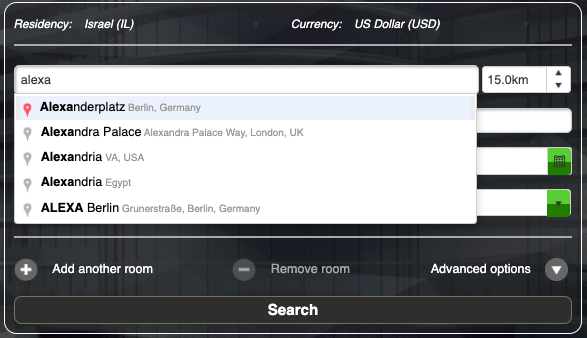
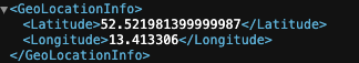
The Geocoding API will transform this location into its corresponding coordinates:
Filter by POI
After conducting the search and presenting the results, HSP offers additional functionality that allows users to filter Points of Interest (POI) and adjust the search radius even after the initial search has been completed.
This can be done both from the Filtering section on the left side:
Or interactively from the map view, just change the Radius, which can filter the POI as close as the radius:
Updated about 2 months ago